Here is how to do your scouting for deer hunting without leaving home.
It's harder and harder these days to carve out time for deer hunting season, let alone scouting for the most productive days of the fall. But thanks to technology, there are now more options than ever when it comes to scouting for deer.
We have some scouting tips today that will not only help identify hotspots from home, they'll also help you to have minimal hunting pressure in your best areas.
These tips will also help anyone scouting a hunting spot in a new area, out of state or out of their familiar range.
Here are some ways to scout for the big bucks from your backyard or computer.
Google Earth & Maps
We can debate the pros and cons of Google and other big tech until the cows come home. But one thing we can agree on, their resources are dynamite scouting tools for deer hunters. Especially anyone looking to harvest a mature buck.
First, both Google Earth and Google Maps have incredible high-resolution satellite views of prime whitetail areas all over the United States and Canada. Especially on public land. In hunting areas with the best resolution images, it's easy to identify potential food sources and funnels as possible spots for tree stands.
If you're lucky, the satellite view was taken anytime from December through March when the leaves are off the trees, exposing deer trails. In some places, travel routes between feeding areas and bedding areas become obvious, making stand location selection a snap.
Another lesser-used tool is Google Street View. This isn't available everywhere, but it does give you a look at a hunting area from the road. Sometimes you can discard a spot without ever traveling to it once you've had a look from the road.
In some areas, you can get an idea of the terrain without looking at a topo map. Click and drag the street view curser over a natural area. If you see a blue dot, that's a photosphere taken at that spot. Drag the curser over it and you'll get a 360-degree view of that spot taken from the ground.
You can even get an idea of hunting pressure in some public areas from Google. Look for the name of a state game area or other hunting ground on the map. If you click on that, it will bring up a side bar of user reviews. Sometimes these reviews give valuable information on how many people hunt there, game species present and other relevant data.
Often, people have uploaded photos of the area here too. Sometimes you'll get lucky and someone will upload a picture of a deer they harvested there, giving you an idea of antler potential.
Cellular Trail Cameras
Isn't technology great? Now, instead of barging into your hunting area and potentially blowing all the deer off your spot, you can wait for photos to start appearing on your phone. It's like the deer are texting you to let you know it's time to start bowhunting!
These types of cameras are usually a little more expensive than more traditional trail cameras, but you'll notice a lot more pros using them because once set up with an external battery or solar panel, they can stay out for literally months on end with no work on your part. All you do is sit there and watch the photos flow in. Meanwhile you can strategize your next move for firearm or archery season.
This style of camera is also a great option for someone who owns private land hundreds of miles away. Gas for scouting trips can be expensive. So, a cellular trail camera will allow you to monitor deer sign and do scouting in the off-season without having to make a big trip.
Just be aware that many of these cameras require you to purchase an additional cellular plan. That's the only downside. But it is a low-impact way to monitor deer movement throughout the year. Other cameras offer a "chain link" system where photos are sent to one camera. This means you could set one up near the outskirts of your property and you only have to check one camera at a time.
Use of a hunting app
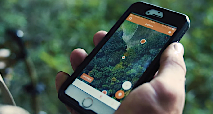
The rise of smart phones and apps has also led to a plethora of deer season scouting tools that you can download in mere minutes. In the case of many hunting apps like Huntwise, onX and many others, they provide the ability to mark all your stand sites, study the terrain and they even analyze weather conditions for you.
Many of these apps go beyond deer scouting. They will also alert you to the best times to go hunting and even the best stand to hunt based on the wind. Apps like Huntwise give you property owner information and even 3-dimensional displays of hunting areas in some locations. That makes it easy to identify ridges, swamps and funnels where deer may be hiding.
While many of these big game hunting apps aren't perfect, they are getting better every year as technology continues to advance. Both in terms of mapping ability and the number of useful features they offer. They're worth checking out if you really want to analyze all the nitty-gritty details of your hunting area.
Migration Reports
For hunting of waterfowl and other species that migrate each fall, the Internet is full of tools that can be utilized to help you find your quarry. There are many sites and apps that can give you these reports. But one really nice one I found is through Ducks Unlimited.
Ducks Unlimited has a waterfowl migration map you can zoom, drag and pan around on to see reports of migration activity. For instance, I found one today that most smaller ducks are already leaving the Upper Peninsula here in Michigan in response to smaller waters starting to ice up.
Meanwhile, outside the main Wide Open Spaces offices in Austin, Texas, I was able to quickly find reports of the number of birds decreasing over the last week. Ducks Unlimited's tools also allow you to sort by the type of activity reporters from the field are posting and it allows you to toggle markers for National Wildlife Refuges where the birds are. We're impressed.
Through a little searching, I was also able to find some state agencies, like the Indiana DNR, offer their own reporting tools through their website where you can garner some vital data. Your license fees are helping pay for these reports, you might as well utilize them!
The simple power of observation
Do you have an oak tree in your yard or neighborhood? You should be keeping an eye on it to know when acorns are dropping. Because deer love a good acorn crop. Do you live in a place that has an urban deer herd? Or near a deer farm or captive herd? Sometimes, observing these un-huntable animals can give you clues as to how the deer are behaving and clue you in as to when you should be hunting.
For instance, if you live in town and the urban deer are laying on their bellies in the neighbor's yard, that's probably not an ideal time to be hunting. But if you nearly run over a buck hot on the trail of a doe on your way to work, you need to consider calling in because they may be up and chasing!
Another option is to find a live deer webcam somewhere in your state and make a point to check it every day for activity to pick the best times to head out.
Maybe when you get home one evening, you notice your farmer neighbor getting his harvester ready for work the next morning. You'd better be in a stand, ready to intercept any animals displaced by the combine's activities.
Simply put, there are indicators of what the deer are doing or may be doing all around you. You just have to keep your eyes and ears open for the clues.
For more outdoor content from Travis Smola, be sure to follow him on Twitter and check out his Geocaching and Outdoors with Travis Youtube channels.
NEXT: HOW TO RUIN A DEER HUNTING SPOT
WATCH


