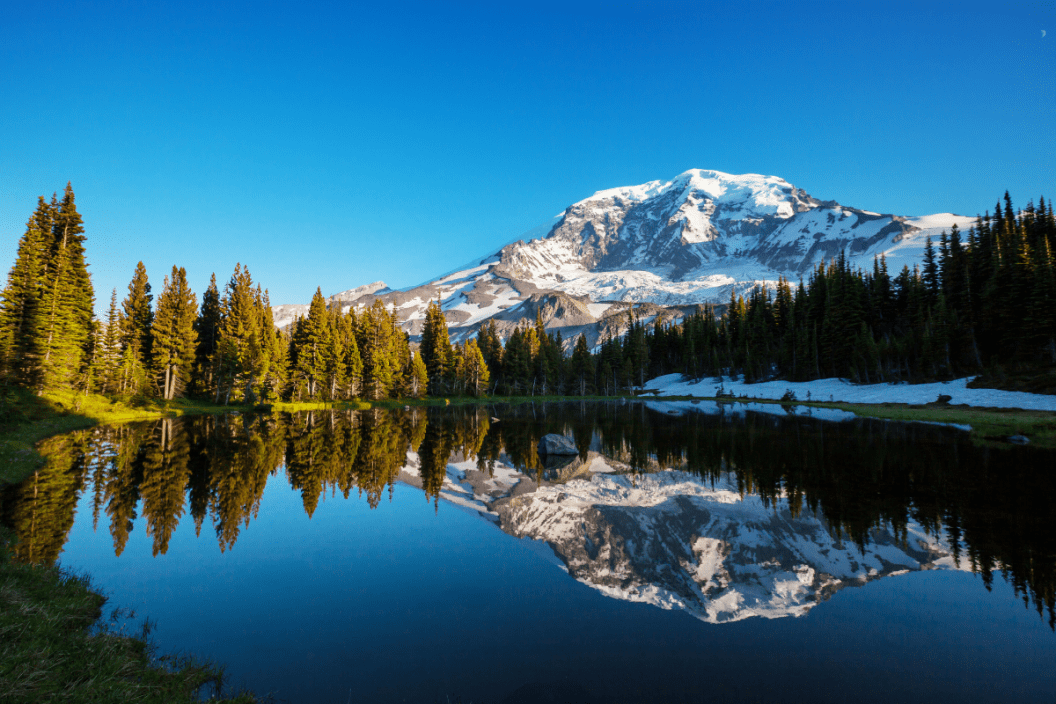
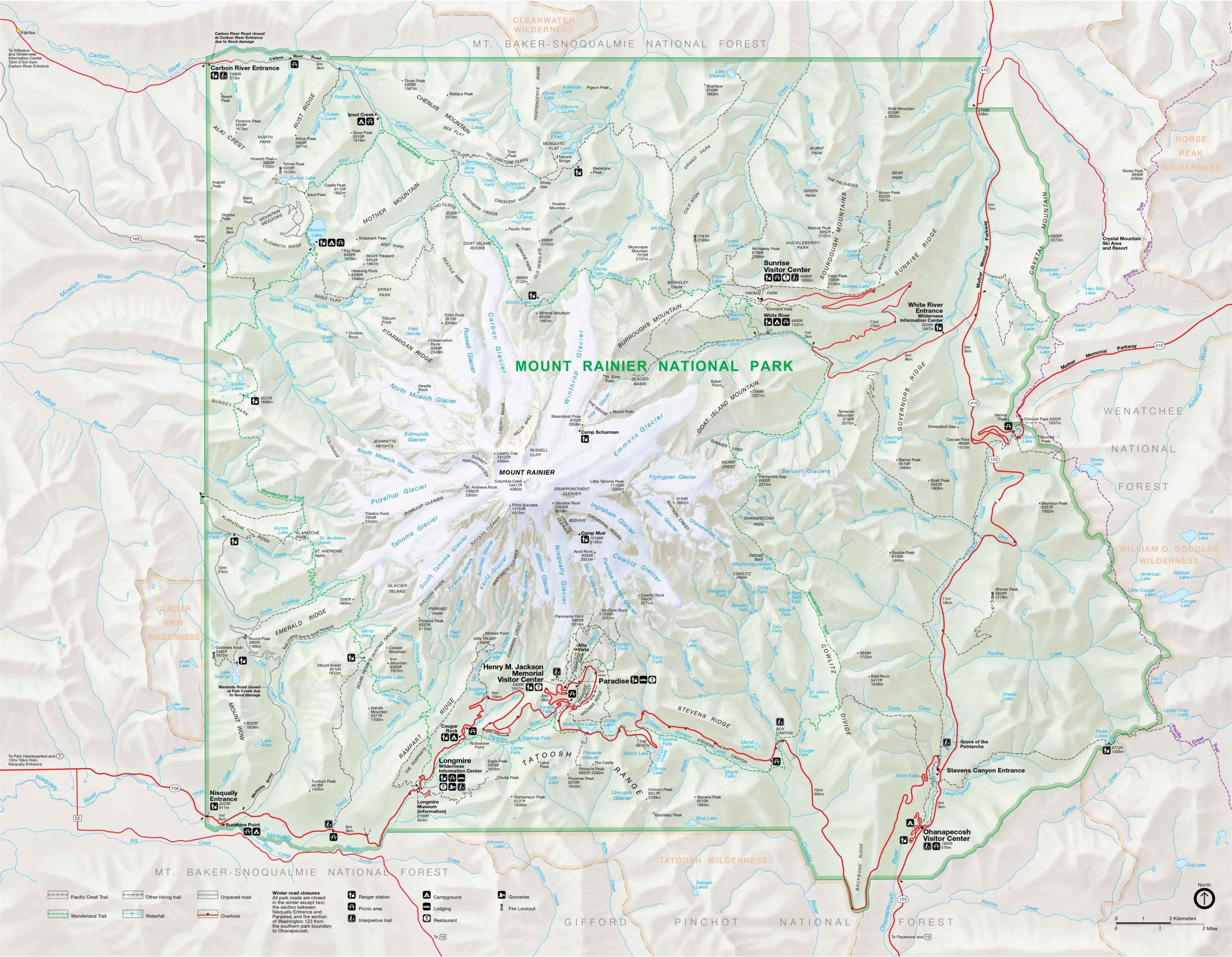
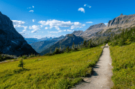
Southeast of Tacoma and Seattle, you'll find Mt. Rainier National Park, one of Washington state's favorite backcountry destinations. The park is full of trailheads that will appeal to both casual day hikers and those who crave some more serious mountaineering. No matter your reason for visiting the park, we hope the following map helps guide your way.
Mount Rainier National Park Map
While this map is great for making general plans, you can find focused trails maps on the National Park Service website at nps.gov. If you're looking for a more detailed topographic map of the region, consider checking out National Geographic's Trails Illustrated collection. Although they aren't free, they are waterproof, tear-resistant, and thorough.
As intricate as the map above is, we know it can get a little overwhelming. Below you'll find useful information to help guide you through it.
Paradise Area
https://www.instagram.com/p/CK3_8ofDepR/
The Paradise region of the park is one of the most well known thanks to its breathtaking views and beautiful wildflower meadows. It has interpretive trails and picnic areas, as well as food and lodging.
- Attractions: Points of interest in the Paradise area include places like Inspiration Point, Reflection Lakes, and the Henry M. Jackson Memorial Visitor Center.
- Trails: There are eight trails in the area ranging from about 1 to 5 miles in length. They include the popular Skyline Trail, which is wheelchair accessible.
- Accommodations: The famous Paradise Inn is located in this part of the park. However, the nearest campground is a bit of a drive.
Longmire Area
https://www.instagram.com/p/CLsla5QBoPR/
RELATED: 10 National Parks & Places to Visit on Your Next June Vacation
This section can be reached by way of the Nisqually Entrance in the park's southwest corner. It is the most used entrance due to its short distance from all the major cities along Interstate 5. Going this way takes you through the town of Ashford, which has a lot of accommodations, from hotels, to campgrounds, and beyond.
- Attractions: The Longmire Museum and the Wilderness Information Center are both located in this easy to reach corner of the park. There are also several scenic points of interest here, a couple of which can be reached by vehicle, as well as the self-guided Historic District Walking Tour.
- Trails: There are 6 official trails in this area, one of which is 9 miles long and passes several sets of falls (see: Narada Falls Trail).
- Accommodations: Here you'll find the RV-friendly Cougar Rock Campground, as well as the cozy National Park Inn, which has its own restaurant and gift shop.
Ohanapecosh Area
https://www.instagram.com/p/CNGbuDVIRXO/
In the southeast region of the park, you'll find the Ohanapecosh Visitor Center. The center has exhibits, a bookstore, and offers guided trail services. A picnic area is located on the banks of the nearby Ohanapecosh River.
- Attractions: Box Canyon river gorge and a bunch of great fishing spots.
- Trails: This part of the park has 11 trails, the most popular of which is probably the Grove of the Patriarchs trail which leads to an island covered with ancient trees.
- Accommodations: The aptly named Ohanapecosh campground is located here. It is only open between May and October. RVs are welcome.
Sunrise Area
https://www.instagram.com/p/CLnXv78sy3z/
Just east of the Burroughs Mountain, this is the highest point on Mt. Rainier you can get to in a vehicle. The easiest way to get there is through the park's White River Entrance. Both the Sunrise Visitor Center and Sunrise Day Lodge are situated at the end of road that leads here.
- Attractions: Yakima Park (yes, there's a park within the park), as well as the visitor center and lodge mentioned above. Additionally, you'll find a historic ranger station, Tipsoo Lake, and others.
- Trails: There are 13 trails in this area, some of which connect with the famous Wonderland Trail that circles all of Mr. Rainier.
- Accommodations: The White River Campground (RVs are O.K.!) is in this area, but pretty far off from the visitor center and lodge. Make sure not to miss the turn out for it. Please note that the Sunrise Day Lodge is not for overnighting.
Carbon and Mowich Areas
https://www.instagram.com/p/CJWrKkcBE55/
The northwest entrance of the park will bring you to the less frequented Carbon River and Mowich Lake area. Although it doesn't look like much on the map, Mowich Lake is the largest and deepest body of water in the park.
- Attractions: As the names suggest, you can look forward to seeing Carbon River and Mowich Lake. Fishing and primitive boating are authorized on the lake.
- Trails: Six trails cross this lonely corner of the park. This includes the 17-mile Carbon Glacier Trail, which is one of Mt. Rainier's longest.
- Accommodations: There's the Ipsut Creek Campground, which is open to hikers since you can only reach it on foot, and the Mowich Lake Campground, which is for primitive tent camping only.
What's your favorite thing to do in Mt. Rainier National Park? Let everyone know on our Wide Open Roads Facebook!
